Storm Boelo batters northern UK as amber wind warnings disrupt travel
Scotland, Northern Ireland and northern England face a second named storm in days. The Met Office warns of dangerous gusts and possible disruption to transport and power supplies.
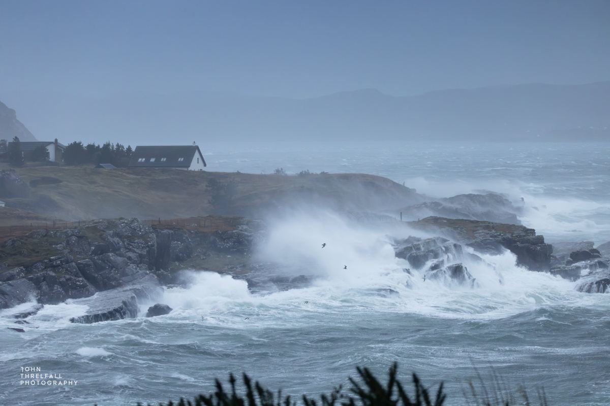
A second named storm in just a few days brought the strongest winds to the north of the United Kingdom on Sunday, October 25. Storm Boelo reached Scotland overnight and moved east, with warnings covering parts of Northern Ireland and northern England. The Met Office has an amber wind warning in force across part of the affected area. It forecasts gusts of 60 to 70 mph, reaching 80 mph on exposed coasts. Those are forecast speeds for the warning area, not readings from every town within it.
The storm has arrived before services have fully recovered from Storm Austen, which struck parts of the country on Friday. Their close succession complicates travel and repairs. A home still without power, or a journey already affected by fallen trees, can face another period of wind and rain before the first disruption has been resolved. The story is not simply how fast the wind blows, but what consecutive storms mean for rail passengers, flights and public events over the weekend.
Sunday plans disrupted
A gust of 82 mph was recorded on the Scottish island of Tiree at about 4 a.m., according to Met Office figures reported by British media. That measurement shows what Boelo can do on an exposed coast; it should not be taken as a nationwide wind speed. Amber warnings cover extensive parts of Scotland, as well as areas of far northern England and Northern Ireland. Yellow warnings extend beyond them. Anyone planning a journey should check the warning for their particular location, since both its severity and its duration vary.
The effects are already visible in daily life. Edinburgh Castle closed on Sunday because of the weather. Liverpool's River of Light installation was cancelled, as was London's Diwali on the Square celebration, on safety grounds, The Guardian reported. On the railway, flooding blocked the line between Preston and Blackpool North, while fallen trees affected tracks near Dumfries in Scotland. These are reported disruptions in specific places, not a shutdown of the national rail network.
Flights were also delayed or cancelled at airports in Britain and Ireland. Airlines and airports may alter their operations as conditions change, so a passenger's live flight status is more useful than a general tally published hours earlier. The same applies to ferries and exposed roads. The official forecast warns that bridges and routes may close temporarily, but any closure is a decision for the relevant authorities or operators.
What an amber warning means
The Met Office uses amber when severe weather has a greater likelihood of significant impacts. For Boelo, it warns of windborne debris, falling branches and trees, damage to buildings, large waves reaching coastal roads and possible power cuts. A warning is not a claim that every one of those effects has already happened. It identifies hazards serious enough to justify changing travel plans or keeping away from the sea.
The strongest winds reached western Scotland on Saturday evening and were expected to spread east through Sunday. The same forecast calls for periods of heavy rain and frequent showers. Saturated ground can make fallen trees and blocked routes an additional concern. The forecaster expects winds to ease gradually from the southwest, while urging people to follow local updates.
Met Office chief forecaster Jason Kelly warned that the storm would be felt widely, with the greatest potential for disruption in the north. That distinction matters. It would be wrong to treat Boelo as a problem confined to one Scottish island, but equally wrong to suggest every British city faces the same level of danger. Strong winds are forecast elsewhere, while confidence in significant disruption is higher inside the amber-warning area.
Storm Austen had already brought gusts of 76 mph to St Mary's Airport in the Isles of Scilly, 74 mph to Aberporth in Wales and 71 mph to Culdrose in Cornwall on Friday. Those figures belong to the earlier storm. Combining them with Boelo's measurements would blur the path and impact of each system. What the sequence does show is that transport and electricity crews are dealing with several days of difficult weather across different regions.
Check before setting out
The Met Office advises people to secure loose objects outdoors, avoid unnecessary journeys and keep away from cliff edges and heavy surf. A large wave can pull someone into the sea even when they are watching from shore. High-sided vehicles are particularly vulnerable on exposed roads. For anyone who must travel, the practical step is to check the current local warning and the latest notice from their transport operator.
Boelo remains a developing story throughout Sunday. The number of affected flights, homes without power or closed routes can rise or fall within hours. This account reflects conditions and forecasts available on the morning of October 25. It does not present warnings as a final assessment of the damage.