Typhoon Cempaka, a Category 2-strength storm, bears down on Japan's remote Ogasawara Islands
U.S. forecasters put its winds near 110 mph as it heads for the island chain that includes Iwo Jima. Japan's weather agency expects the closest pass late Tuesday into early Wednesday local time, with 20-foot waves. The storm is not forecast to reach Japan's main islands.
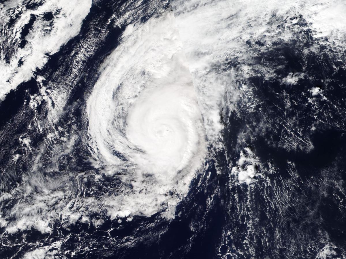
A typhoon with winds near 110 mph is closing in on the Ogasawara Islands, a remote Japanese chain in the Pacific about 620 miles south of Tokyo, and forecasters expect it to pass close by within the next day before heading out to sea.
The storm, named Cempaka, is the equivalent of a strong Category 2 hurricane, based on wind estimates from the U.S. military's Joint Typhoon Warning Center (JTWC) in Pearl Harbor. The Japan Meteorological Agency (JMA) expects it to make its closest approach to the islands between late Tuesday night and the pre-dawn hours of Wednesday, Japan time. That is roughly Tuesday morning into early afternoon on the U.S. East Coast.
The Ogasawaras, also known as the Bonin Islands, are administered by Tokyo and have no airport. The populated islands, Chichijima and Hahajima, are reached by a ferry that takes about a day from the capital. The chain also includes Iwo To, the island Americans know as Iwo Jima.
How strong it is
In its warning issued at 4 p.m. Eastern time on Monday, the JTWC estimated sustained winds of 95 knots (about 110 mph) with gusts to 115 knots (about 130 mph), and placed the center roughly 295 miles west of Iwo To, moving east-northeast.
Japan's weather agency reported the storm at about the same time with a central pressure of 970 hectopascals, sustained winds of 40 meters per second (about 90 mph) and gusts of 55 meters per second (about 123 mph), moving east-northeast at about 12 mph. It classifies Cempaka as a "strong" typhoon. Winds of 56 mph or more extended about 47 miles from the center.
The two sets of numbers describe the same storm. Japan averages wind speed over 10 minutes, while U.S. agencies use a one-minute average, which produces higher figures. The names differ too: Japanese forecasters call it Typhoon No. 32 of the season, while the JTWC tracks it as Typhoon 31W.
The storm strengthened overnight. On Monday afternoon in Japan it was moving slowly north-northwest; it then turned sharply east, steered by upper-level westerly winds, according to the Japan Weather Association.
What the islands can expect
For Tuesday and Wednesday, the JMA forecasts sustained winds on the islands of up to 56 mph with gusts to 78 mph, very rough seas with waves of about 20 feet, and as much as 4 inches of rain in 24 hours in the wettest spots, with thunderstorms. The agency is urging residents to be on alert for the wind and high surf and to watch for landslides, lightning and sudden gusts.
The JMA's forecast track takes the center just south of the inhabited islands. The margin of error at that range is about 40 to 58 miles, so how close the core comes to Chichijima and Hahajima could still change.
At the time of writing, the website of the ferry operator, Ogasawara Kaiun, showed no notice of schedule changes because of the storm, and the Japanese news reports reviewed did not mention damage or evacuations.
Where it goes next
Neither agency's forecast brings the typhoon toward Japan's main islands. The JMA places it by early Thursday local time far out over open water, near 29 degrees north and 155 degrees east. The JTWC expects it to weaken to about 80 mph and begin losing its tropical characteristics around 1 a.m. Eastern time on Wednesday.
The mainland will feel it only indirectly. The Japan Weather Association warns that swells from the storm will reach Japan's Pacific coast from the Tokai region to Kyushu, as well as Okinawa and Amami, and that such long-period swells can be dangerous even when the waves do not look high.
A note on the forecasts
Typhoon forecasts change with each update. The figures here reflect bulletins issued Tuesday morning in Japan; the JMA said its next bulletin would come Tuesday afternoon local time.